Puerto De Santiago and Playa De La Arena
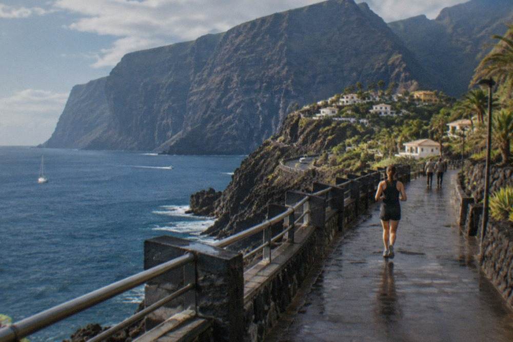
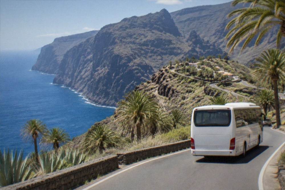
Puerto de Santiago sits on Tenerife's west coast in the municipality of Santiago del Teide, beside the Los Gigantes cliffs that Turismo de Tenerife describes as towering up to 600 m above the sea.
Short answer
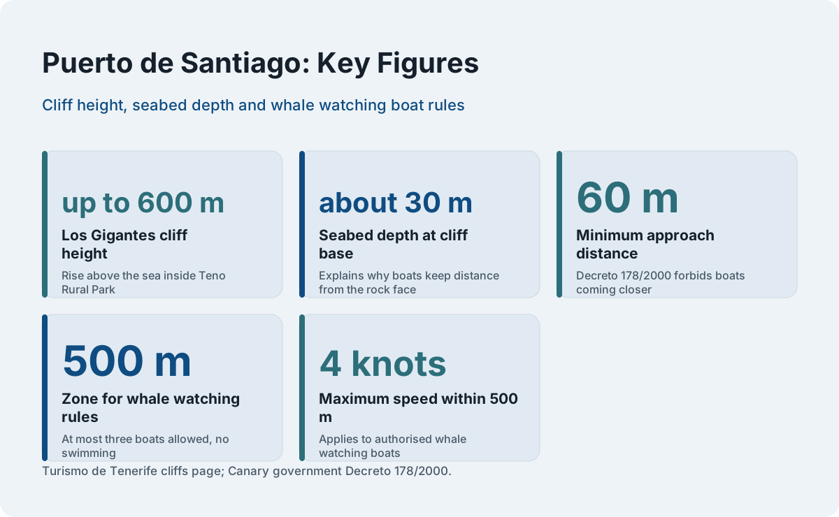
Puerto de Santiago is a quiet west-coast resort in the municipality of Santiago del Teide, next to Los Gigantes and the beach at Playa de la Arena. The cliffs rise up to 600 m, the seabed at their foot is about 30 m deep, and the whole stretch sits inside Teno Rural Park.
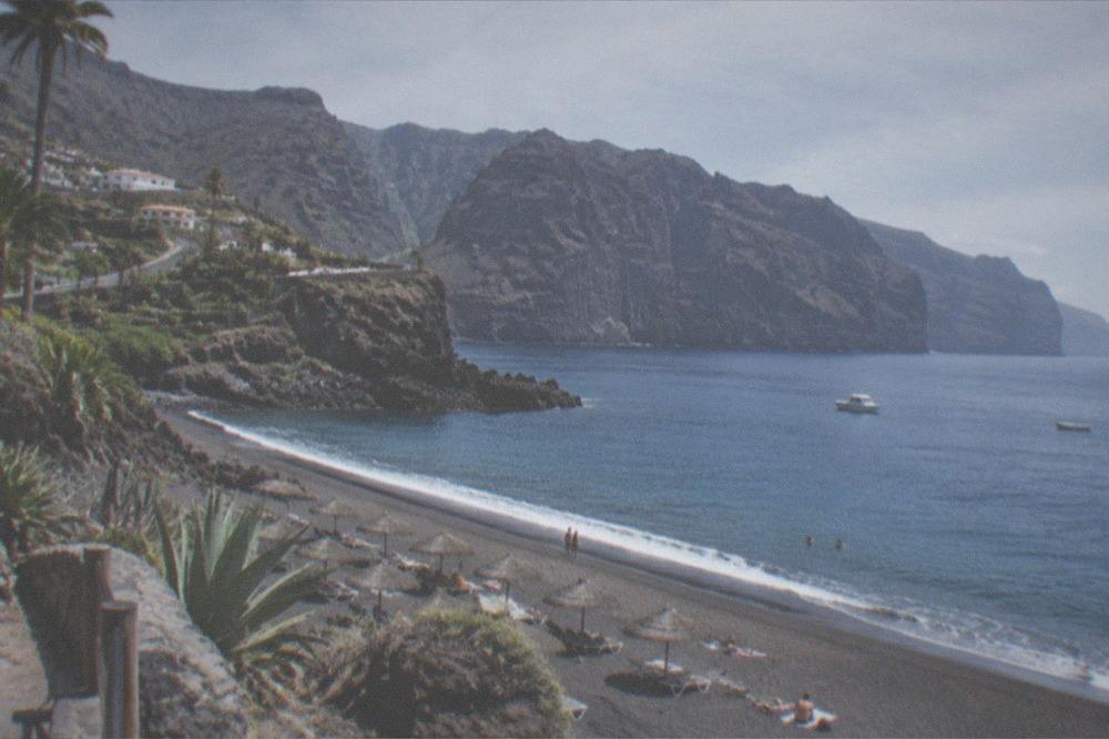
Puerto de Santiago sits on the west coast of Tenerife, in the municipality of Santiago del Teide, one of the island's 31 municipalities and home to 12,582 registered residents. The resort clusters around a small former fishing harbour, with the neighbouring beach resort of Playa de la Arena immediately south along the coast and the larger holiday base of Los Gigantes to the north. What sets the whole stretch apart is geology rather than nightlife: the Los Gigantes cliffs, which Turismo de Tenerife describes as towering "up to 600 m (1,970 ft) high" above water that is about 30 m deep at their foot, sit inside Teno Rural Park and frame almost every seaward view in the area.
This page gathers what the official sources say about the resort and its surroundings: where it sits, what the cliffs are, what leaves from the local piers, what the climate tables record for the south-west of the island, and how the area works as a base for exploring further afield. It is written as an editorial desk report, not a travel diary, and every figure below comes from an official source.
Where Is Puerto de Santiago on the Map of Tenerife?
Puerto de Santiago is on Tenerife's west coast, inside the municipality of Santiago del Teide, between the resort of Los Gigantes to the north and the beach at Playa de la Arena to the south. The municipality recorded 12,582 residents, and the whole coastal strip sits at the foot of the Los Gigantes cliffs, which rise up to 600 m and belong to Teno Rural Park.
Santiago del Teide is one of the smaller municipalities on the island by population, but it holds one of the most dramatic stretches of coastline in the Canaries. The tourist board's own page for the cliffs records both the height, "up to 600 m (1,970 ft)", and the depth of the seabed at their base, about 30 m, which explains why the boat traffic along this coast keeps a respectful distance from the rock face. The village of Masca, the gorge walk that now runs as a pre-booked descent with a boat exit from Masca bay, also belongs to this municipality, inland and uphill from the coast.
For orientation, the nearest well-known neighbours along the coast are Playa San Juan and Alcala to the south, and the quieter bases of Playa Paraiso and La Caleta further south still, heading towards Costa Adeje. To the north, the road climbs into the Teno massif towards Buenavista del Norte. The resort is a genuinely good base for people who want the west of the island rather than the nightlife belt of Playa de las Americas, which the Los Cristianos vs Costa Adeje comparison covers in detail.
What Kind of Holiday Does Puerto de Santiago Suit Best?
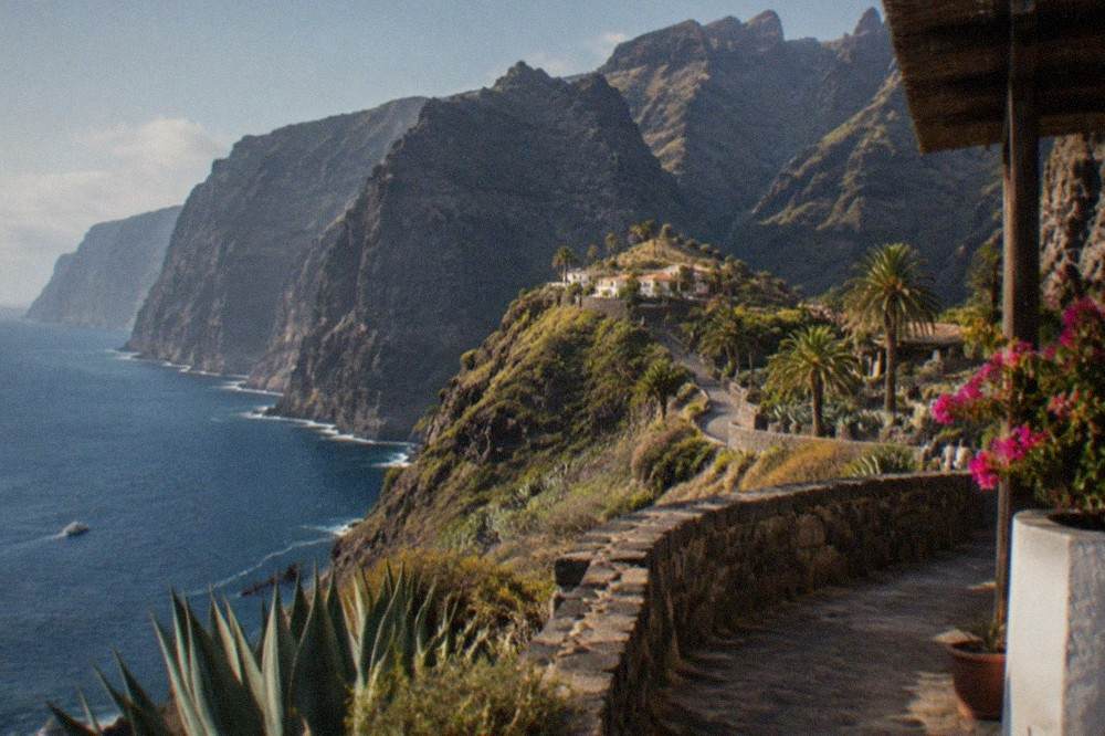
Puerto de Santiago suits travellers who want a quieter west-coast base with sea views, boat access to the cliffs and whale watching, and short drives into Teno Rural Park, rather than the concentrated nightlife of the south's resort belt. The resort sits between Los Gigantes and Playa de la Arena, and its position makes day trips by sea and by road the natural way to use the area.
The resort's character follows from its geography. The harbour is small, the waterfront faces open Atlantic, and the cliffs dominate the outlook in a way that no purpose-built resort on the south coast can match. The trade-off is distance: the big water parks and animal parks of the south are a drive away, and the airport transfer is longer than from Costa Adeje. For families weighing that trade-off, the Tenerife with kids planning page lays out which attractions sit where, and the things to do in Tenerife round-up lists the full spread of options island-wide.
Two kinds of day out work especially well from here. The first is the sea: whale and dolphin watching trips leave from Los Gigantes and the surrounding piers, and the resident pilot whale population off the south-west coast is the reason so many operators base themselves on this side of the island. The second is the volcano: the road east climbs to Roques de Garcia and the rest of Teide National Park, which AENA and the park's own figures place among the most visited protected landscapes in Spain.
How Do the Los Gigantes Cliffs Shape the Whole Coast?
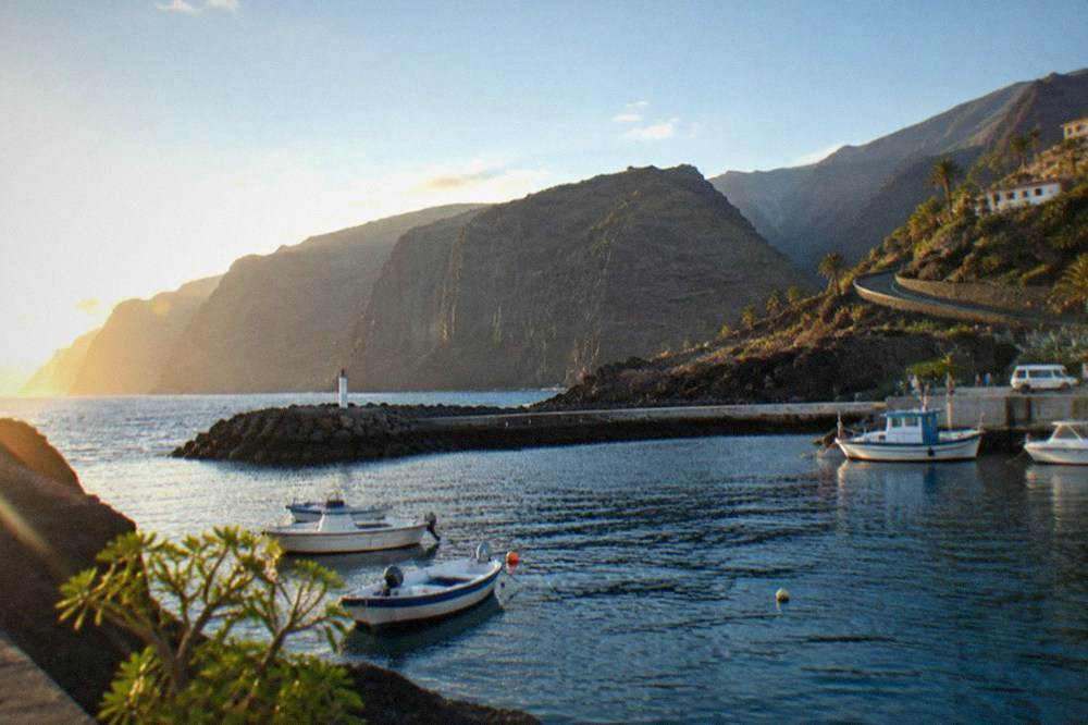
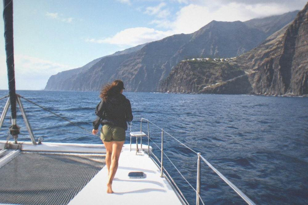
The Los Gigantes cliffs rise up to 600 m above a seabed about 30 m deep, run inside Teno Rural Park, and turn the coast from Puerto de Santiago northwards into a wall of dark volcanic rock that is best seen from the water. Turismo de Tenerife gives the height and depth figures on its own page for the cliffs, and no other height should be quoted.
The cliffs are the reason this coast exists as a holiday destination at all. The town of Los Gigantes takes its name from them, the boat trips sell them as the backdrop, and the drive north along the coast road keeps them on the right-hand side for much of the way towards Buenavista del Norte and the Teno Alto and Buenavista backcountry. The tourist board's page is precise on the two numbers that matter: "up to 600 m (1,970 ft) high", and a seabed about 30 m deep at the foot. Older guides sometimes print 800 m; that figure is not the tourist board's and this site does not repeat it.
Seeing the cliffs from the water is the classic half-day from Puerto de Santiago, and several operators run cruises from the local piers with a swim stop in one of the coves.
The cliffs also matter for what lives beside them. The stretch of water off the south-west of Tenerife is a Special Area of Conservation, and the World Cetacean Alliance records that the Tenerife-La Gomera Marine Area became a designated Whale Heritage Area in January 2021, describing a unique resident population of pilot whales alongside bottlenose dolphins, with 21 other cetacean species passing through on migration. The designation is the World Cetacean Alliance's, not UNESCO's, and no official whale population count exists to quote.
What Boat Trips and Water Sports Run from the Local Piers?
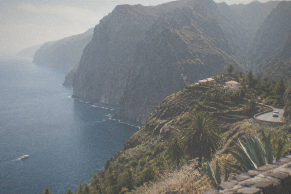
Whale and dolphin watching is the main sea trip from this coast, on boats authorised under Decreto 178/2000, which forbids approach within 60 m, allows at most three boats within 500 m, sets 4 knots as the maximum within 500 m and bans swimming within 500 m, and authorised boats fly the Barco Azul flag. Kayaking, sailboat cruises and swim-stop trips run alongside them from Los Gigantes and Los Cristianos.
The rules are worth knowing because they are what separates a legal trip from a stressful one for the animals. The Canary government's Decreto 178/2000 sets the distances in law, and article 15 requires authorised boats to fly the Barco Azul, or Blue Boat, flag issued with their permit and renewed annually. A reader standing on the pier in Puerto de Santiago can check for that flag before boarding anything.
Trips from this side of the island typically combine the cliffs with the whale grounds, since both sit in the same stretch of water. A cruise with a swim stop under the cliffs is the most popular format, and a sailboat version runs for visitors who prefer a quieter hull. For a decision between the main options, the whale and dolphin watching round-up compares the operators, and the boat trips and catamarans page covers the cruise formats. One Los Gigantes cruise with a swim stop is rated 4.7 from 5,673 reviews and runs two hours, and a sailboat version is rated 4.9 from 2,264 reviews over three hours: the Los Gigantes area guide covers the town itself, and the tour cards above carry the live prices and availability for both formats.
Beyond the boats, the west coast's wind and swell make it a workable spot for learning sports that need both. Surf lessons cluster on the south coast at Playa de las Americas, and the surf lessons page explains what a first lesson covers, with photos usually included. Kayaking with turtles runs from Los Cristianos, covered on the kayaking with turtles page.
What Is the Weather Like on the West Coast?
AEMET's climate normals for Tenerife South Airport, the nearest long-record station to this coast, show mean daily maxima of 21.7 Celsius in January rising to 28.4 in August, with 132 mm of rain across the year on 15.2 rain days, and the sea off the south of the island runs from 19.1 Celsius in March to 23.7 in September and October.
The airport station sits at 64 m on the south of the island and is the closest of AEMET's four Tenerife stations to this coast, so its normals are the fairest published guide to what the resort's weather is like. The mountains change everything, of course: AEMET's Izana station on the Teide ridge records January mean daily maxima of 7.5 Celsius and 47 mm of rain, which is why a single island can hold a beach holiday and a winter mountaineering day on the same afternoon. The Tenerife weather by month guide unpacks all four stations month by month.
| Month | Mean daily max (C) | Mean daily min (C) | Rain (mm) | Rain days (1 mm or more) | Sunshine (hours) |
|---|---|---|---|---|---|
| Jan | 21.7 | 15.2 | 17 | 1.8 | 193 |
| Feb | 22.0 | 15.0 | 20 | 2.2 | 195 |
| Mar | 23.1 | 15.6 | 15 | 1.9 | 226 |
| Apr | 23.1 | 16.0 | 7 | 1.1 | 219 |
| May | 23.9 | 17.0 | 1 | 0.3 | 246 |
| Jun | 25.4 | 18.8 | 0 | 0.0 | 259 |
| Jul | 27.7 | 20.2 | 0 | 0.0 | 295 |
| Aug | 28.4 | 21.1 | 1 | 0.2 | 277 |
| Sep | 27.9 | 21.1 | 4 | 0.6 | 213 |
| Oct | 26.8 | 20.0 | 12 | 1.6 | 214 |
| Nov | 24.8 | 18.2 | 26 | 1.9 | 193 |
| Dec | 22.8 | 16.5 | 30 | 3.5 | 195 |
The sea temperature table comes from a different dataset, NOAA's 1991-2020 series for the south coast, so the two tables carry two different reference periods and should not be merged into one. The wider set of guides lives on Tenerife Travel Guide.
| Month | Sea surface temperature (C) |
|---|---|
| Jan | 19.9 |
| Feb | 19.2 |
| Mar | 19.1 |
| Apr | 19.5 |
| May | 20.2 |
| Jun | 21.4 |
| Jul | 22.2 |
| Aug | 23.1 |
| Sep | 23.7 |
| Oct | 23.7 |
| Nov | 22.5 |
| Dec | 21.1 |
Where Can You Eat and Stay Around Puerto de Santiago?
The resort and its neighbours hold a spread of seafront restaurants and self-catering accommodation, and the official record that matters most to visitors is that no per-night lodging tax exists or is approved on Tenerife: the charges that do exist are per-booking fees on certain Teide trails, the Masca ticket and the Barranco del Infierno ticket, none of which is a hotel tax.
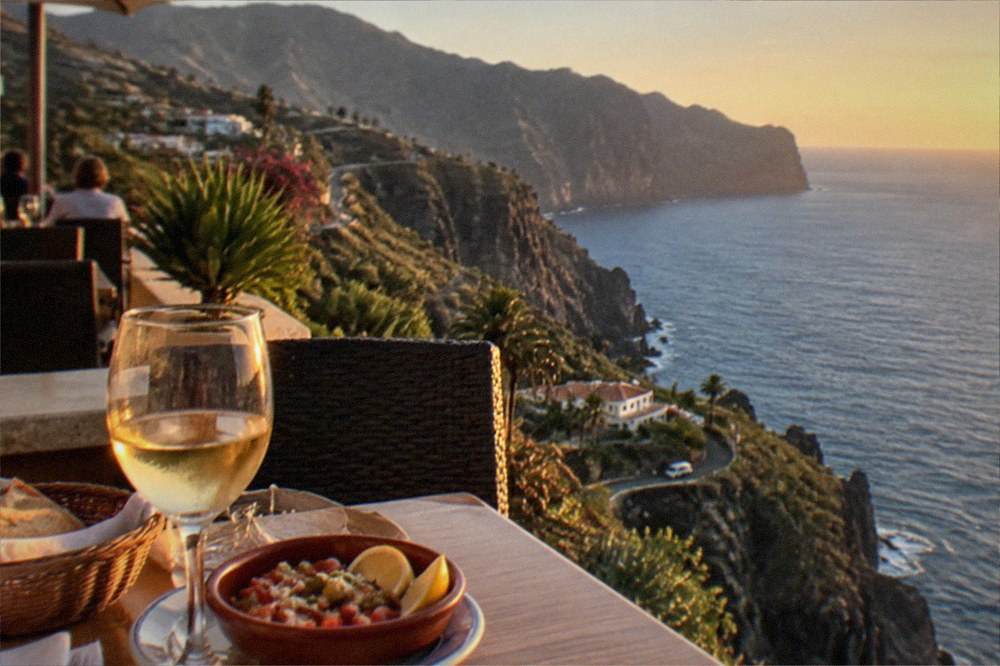
Eating out on this coast leans on the fishing heritage rather than on themed restaurants, and the island's own food traditions are worth seeking out wherever the menu lists them. The papas arrugadas and mojo guide explains the islands' signature potato dish and its two sauces, and the guachinches guide covers the informal, licence-limited home kitchens of the north that serve their own wine, several of which sit within reach of a drive up the TF-82 towards Icod de los Vinos.
On stays, the honest position is this: rates move daily with season and demand, so no nightly figure belongs on this page. What drives the price is the time of year, the view and how early you book, and for a quiet west-coast base with sea views it is worth comparing the self-catering and hotel options before committing: see stays across the island. For the broader question of which area suits which traveller, the where to stay in Tenerife guide compares the whole island.
What Day Trips Work from a West-Coast Base?
La Gomera is the headline day trip from this coast, a 50-minute ferry from Los Cristianos to San Sebastian de La Gomera with Fred. Olsen Express, while the island's own big-hitters, Teide National Park, Masca, Garachico and Icod de los Vinos, all sit within a single loop drive inland and north.
The ferry table below is Fred. Olsen Express's own published schedule from Los Cristianos, the port that serves this coast. Armas Trasmediterranea also sells the La Gomera route, and the island hopping and ferries guide covers the fuller picture, including the La Gomera day trip options with and without a car.
| Route from Los Cristianos | Sailing time |
|---|---|
| San Sebastian de La Gomera | 50 minutes |
| Santa Cruz de La Palma | 150 minutes |
| Valverde, El Hierro | 140 minutes |
On the island itself, the classic loop from this coast runs Masca, Garachico and Icod, and the Masca, Garachico and Icod route page walks through it. Garachico's own history explains the coast's shape further north: the Trevejo volcano erupted in 1706, destroyed almost the entire town and buried the old port, ending Garachico's run as the island's trade hub of the 16th and 17th centuries. The Garachico natural pools are what the town offers swimmers today.
Masca needs planning, not just a car. The gorge is open under a pilot scheme as a descent-only walk with a pre-booked boat exit from Masca bay, the general ticket is EUR 40.66 with the boat charged separately, and hikers must arrive on TITSA line 355 from Santiago del Teide and show the bus ticket, because arriving by private vehicle means refusal. The booking site is caminobarrancodemasca.com, not Tenerife ON. The Masca attraction page holds the full rules, including the closed mountain footwear requirement and the fact that a sudden pier closure from sea conditions voids that day's ticket.
Teide is the other obvious inland trip. The cable car runs from a base station at 2,356 m to La Rambleta at 3,555 m, and the summit crater beyond is a separate reservation-only trail booked on Tenerife ON, with the 09:00 to 17:00 slots costing EUR 15 for visitors since 19 January 2026. The Teide summit permit guide holds every rule, and the Teide tours page compares the guided options. For a full day built around the volcano from this side of the island, the Teide from the south itinerary is the closest fit.
Do You Need a Car to Stay in Puerto de Santiago?
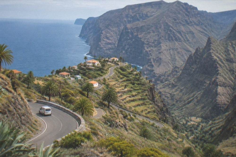
A car is useful but not essential: TITSA buses serve the west coast and connect it to the airports and the south's hubs, visitors pay for public transport through single tickets, the EUR 10 day travelcard or the EUR 50 seven-day travelcard, and the 2026 free-travel subsidy applies only to resident passes held by people resident in the Canary Islands.
The free public transport that made headlines in the Canaries is real but it is not for holidaymakers: the 100% subsidy that has applied since 1 January 2026 covers resident passes on a personalised Ten+ card, and every subsidised pass requires residency. Visitors buy single tickets, priced by route, or the travelcards below, sold at airport ticket machines among other places. Taxis are white and metered from the start of the trip, with a fixed price negotiable in advance for excursions.
| TITSA visitor product | Price | Notes |
|---|---|---|
| Single ticket | Priced by route | Card or cash |
| Same-day return | 10% off | On trips of 20 km or more |
| Day Travelcard | EUR 10 | Unlimited same-day travel |
| 7 Day Travelcard | EUR 50 | Seven consecutive days |
| Ten+ card | EUR 2 | Top-ups from EUR 2 to EUR 100 |
The Tenerife buses guide has the line-by-line detail, and the do you need a car in Tenerife answer weighs the question for the island as a whole. For anyone who does drive, the driving in Tenerife guide covers the roads, including the mountain routes this coast depends on.
What About Evenings, Shows and the Bigger Parks?
Evenings on this coast are quiet by design, and the bigger nights out involve travelling: Loro Parque in Puerto de la Cruz is the island's flagship animal park, open 09:30 to 17:30 every day of the year with its own car park at EUR 7 per day, while evening shows, flamenco and medieval banquets run from the south coast resorts.
Loro Parque is a genuine draw for families based on the west coast, and it is the related pick on this page because a day there is the single most popular paid attraction for visitors staying this side of the island. The entry ticket is best booked ahead, since the park opens every day of the year and peak days fill its car park: Check availability, or read the zoos and animal parks guide for how it compares with the alternatives. The Loro Parque attraction page holds the full visiting detail.
For evenings, the honest summary is that Puerto de Santiago is not the island's nightlife capital, and most visitors who want a show travel for one. A flamenco production by Fran Chafino runs from Costa Adeje with hotel pickup, and a second flamenco show plays at the Teatro Timanfaya in Puerto de la Cruz, both covered on the medieval night and shows page. The Tenerife nightlife guide maps where the island's late evenings actually happen, and the Santa Cruz Carnival page covers the one week in the year when the island's evening calendar overwhelms everything else, with the 2027 programme themed "Roma: El imperio del Carnaval".
For visitors who want height rather than a stage, tandem paragliding flights run from the Costa Adeje side of the island, and the paragliding page explains what a first flight involves: the tour cards below carry the live prices and availability for a tandem flight with a national champion pilot, rated 4.9 from 1,216 reviews.
Common Questions About Puerto de Santiago
Is Puerto de Santiago the same place as Playa de la Arena?
No, they are neighbouring resorts in the same municipality, Santiago del Teide. Puerto de Santiago sits around the former fishing harbour, with Playa de la Arena immediately south along the coast road and Los Gigantes to the north. The three are effectively one continuous waterfront for most holiday purposes.
How far is Puerto de Santiago from the Los Gigantes cliffs?
The cliffs run along the whole of this stretch of coast, and the tourist board describes them as towering up to 600 m above a seabed about 30 m deep at their foot, inside Teno Rural Park. The town of Los Gigantes, which takes its name from them, is the next resort north of Puerto de Santiago, and no walking time between the two is stated here because none has been measured.
Can you see whales from Puerto de Santiago?
Boat trips rather than the shore are the reliable way to see them. The World Cetacean Alliance records a unique resident population of pilot whales and bottlenose dolphins in the Tenerife-La Gomera Marine Area, a designated Whale Heritage Area since January 2021, and authorised boats fly the Barco Azul flag under Decreto 178/2000, which forbids approaching within 60 m.
Is there a tourist tax on accommodation in Puerto de Santiago?
No per-night lodging tax is in force or approved on Tenerife, according to every official page this site has read. The charges that do exist are per-booking fees on certain Teide trails, the Masca ticket and the Barranco del Infierno ticket, and none of them is a hotel tax.
Is the sea warm enough to swim around Puerto de Santiago?
For most of the year, yes by northern European standards. NOAA's 1991-2020 series for the south of the island records sea surface temperatures from 19.1 Celsius in March to 23.7 in September and October, and the sea never drops below 19 Celsius in any month of that series.
Can you visit La Gomera from Puerto de Santiago?
Yes, and this coast is the best-placed part of Tenerife for it. Fred. Olsen Express sails the Los Cristianos to San Sebastian de La Gomera route in 50 minutes, Armas Trasmediterranea also sells the route, and organised day trips with lunch run from the south of the island.