Garachico
Garachico is the town a volcano buried and the sea rebuilt. This guide reports what the official record says about the 1706 eruption, the natural pools, the bus routes in, and the day trips that pair well with it.
Short answer
Yes. Garachico is worth visiting for its 1706 eruption history, its sea-fed natural pools, and its position on the north-west route that pairs with Icod de los Vinos and the Masca road. It is reached by TITSA bus from Puerto de la Cruz or Icod, and entry to the town itself costs nothing.
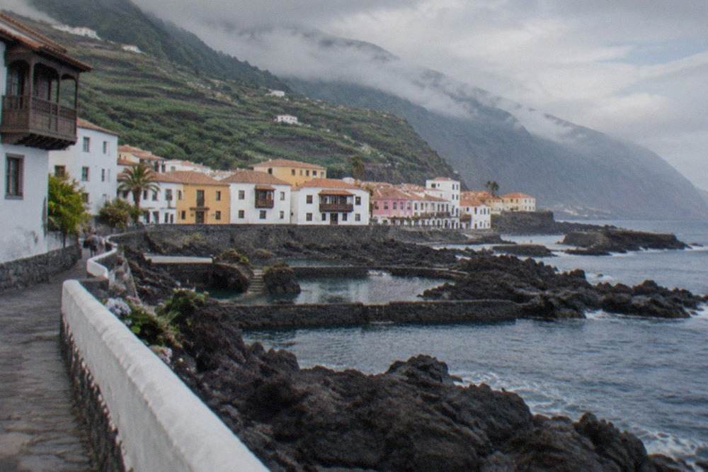
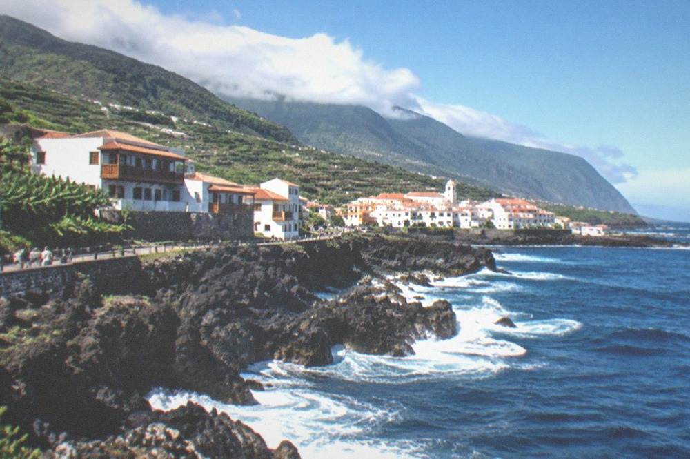
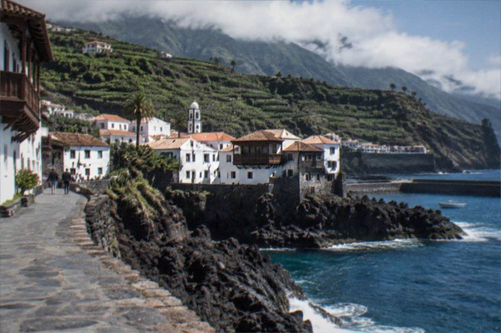
Garachico sits on Tenerife's north-west coast, and its whole character comes from a single year. Turismo de Tenerife's page for the municipality records that the Trevejo volcano erupted in 1706, destroyed almost the entire town and buried the old port, and that before that catastrophe Garachico had been the island's trade hub in the 16th and 17th centuries. A port town that lost its port, and a seafront that was rebuilt on lava, is not a story a writer needs to embellish. This guide reports what the official sources say about the town, its pools, its transport links and the day trips that fit around it.
Is It Worth Visiting Garachico?
Yes. Garachico rewards a visitor with a preserved historic quarter built on 1706 lava, sea-fed natural swimming pools along the water's edge, and a location that anchors the classic north-west loop through Icod de los Vinos and the Masca road. The town itself is free to enter and walk, the tourist board records its 16th and 17th century past as the island's trade hub, and its post-eruption story makes it unlike any other town on the island.
The honest case for Garachico is that it is the anti-resort. Where Costa Adeje and Playa de las Américas grew around beaches and nightlife, Garachico's seafront is dark rock, its architecture is Canarian rather than international, and its history is written in stone you can stand next to. The tourist board's own municipal page is the source for the eruption and the trade-hub past, and it is the framing every later guide repeats.
What the town does not offer is a conventional beach. The coast here is lava, and swimming happens in the natural pools the sea fills, which the tourist board lists among the municipality's attractions. Anyone whose holiday depends on long golden sand should read the guide to Tenerife's golden sand beaches first, because the north-west is not that island.
There is a quieter argument for the town as well, and it is the one long-stay visitors tend to make. Garachico is small enough to see properly in a morning and atmospheric enough to hold an afternoon, which makes it the rare Tenerife stop that improves when the day-trippers thin out. The trade hub that the eruption ended was a real thing for two centuries, and the scale of the surviving quarter, churches, courtyards and balconied houses, reflects that wealth rather than a fishing village's. That contrast, prosperity frozen by catastrophe, is what the official record actually describes.
What Happened to Garachico in 1706?
The Trevejo volcano erupted in 1706, destroyed almost the entire town and buried the old port, ending Garachico's run as the island's trade hub of the 16th and 17th centuries. Turismo de Tenerife's municipal page is the source for all three facts, and no date before or after that year is on file. The lava that buried the harbour is now the rock the town's sea pools sit in.
That single sentence from the tourist board carries most of what a visitor needs. The eruption is why the seafront is black rock rather than a working quay. It is why the town's wealth moved elsewhere and its old quarter survived without later redevelopment pressure. And it is why the natural pools exist at all: the sea fills the voids in the buried lava flow.
The rock itself is the sight. The tourist board's page for the municipality treats the eruption and the trade-hub past as the town's defining facts, and a walk through the old quarter is essentially a reading of them: 16th and 17th century buildings that survived, lava that did the burying, and a seafront rebuilt on top of it. No invented dates, no named architect, nothing beyond what the record states.
It is worth being precise about what the record does and does not say, because popular retellings add detail the sources do not hold. The verified facts state the eruption year, the near-total destruction, the burial of the old port and the two centuries of trade dominance. They do not state a death toll, a number of buildings lost, a duration of the eruption or a name for the flow beyond the volcano's own. A guide that fills those gaps is guessing, and this one will not. What can be said with confidence is the consequence: the port never came back, the trade moved, and the town that remains is the one the lava spared.
What to Do in Garachico, Tenerife?
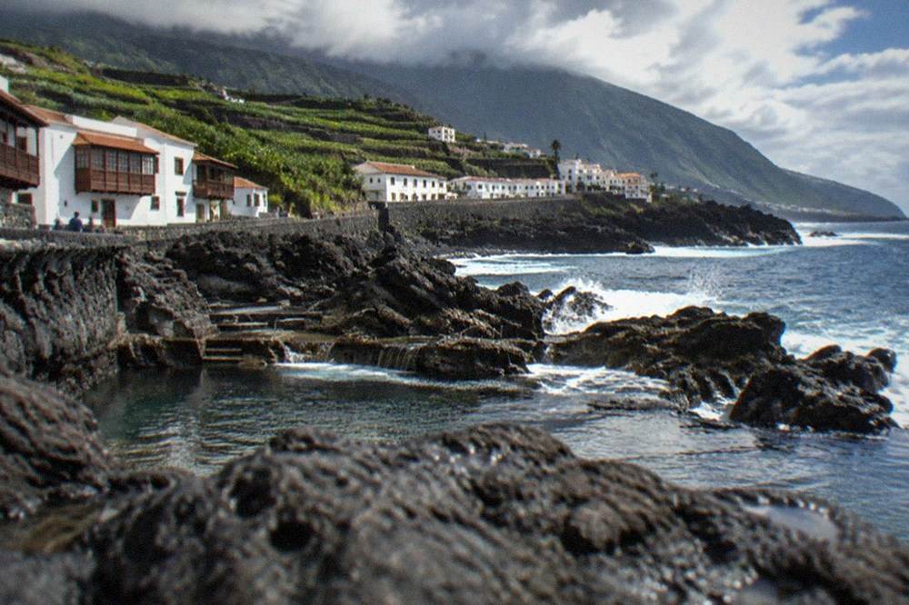
The core of a visit is the historic old quarter, the natural pools carved and filled along the lava seafront, the sea views out to the small offshore islet, and the town's role as the stop on the Masca, Garachico and Icod route. The pools are the town's headline attraction, the old quarter costs nothing to wander, and everything sits within a compact town that TITSA buses reach directly.
The pools come first, and this site keeps a full page on the Garachico natural pools with what the official listing states. They are sea-fed basins in the lava flow, which means swimming in them depends on sea conditions rather than a lifeguard's flag alone: when the Atlantic is rough on this coast, the pools are where it shows. Check conditions before you plan a swim, and treat the pools as a weather-dependent part of the day, not a guaranteed one.
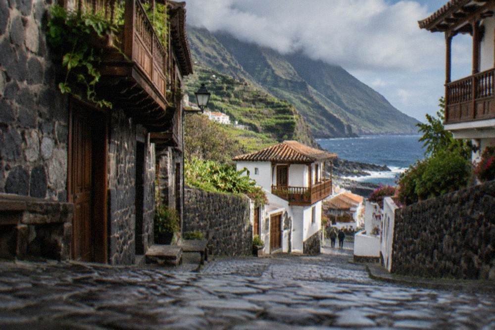
The old quarter is the second thing. The tourist board's record of the 1706 destruction and the trade-hub centuries gives every street a context, and the town's Canarian architecture, wooden balconies and dark stone is what most visitors come away talking about. There is no ticket, no queue and no timed entry for any of it.
The third thing is the town's position. Garachico is the middle stop of the classic north-west loop, and this site's Masca, Garachico and Icod route page lays out the full day. A guided version covers the same ground without a car: the Masca, Los Gigantes and natural pools tour pairs the gorge with a picnic and the coast, and its live listing carries the current price and departure points.
Beyond the headline sights, the town rewards slow time. The seafront itself is a walk over the lava shelf, with the Atlantic working at the rock the eruption delivered, and the views out from the water's edge take in the small islet that sits just offshore. Inland, the municipality climbs into green slopes, and the road toward La Orotava and the north's wine country passes through some of the island's most photographed landscape. None of it needs a booking, which is precisely the point of a town like this.
Where Are the Garachico Natural Pools and When Can You Swim?
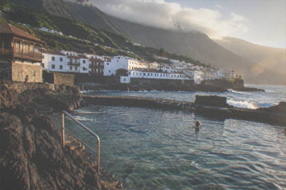
The natural pools sit directly on Garachico's seafront, formed where the sea fills basins in the 1706 lava flow that buried the old port. Swimming in them depends on Atlantic conditions on this exposed north-west coast, and no opening hours or season dates for the pools are on file, so the honest planning advice is to treat sea state, not a timetable, as the deciding factor.
This site's dedicated page for the Garachico natural pools holds what the official listing publishes, and it is the page to check before a swim day. What can be stated here is the geography: the pools are part of the same lava flow the eruption left, the town wraps around them, and the Atlantic fills them directly, which is why calm days and rough days look like two different attractions.
The north-west coast is not the south. Around Los Cristianos and the southern resorts the sea is often calm behind headlands, while this coast takes the open Atlantic. The practical consequence is simple: build the pools into a flexible day, keep the old quarter as the fallback, and let the sea decide the order.
A word on safety, from the record rather than from imagination. The tourist board lists the pools among the municipality's attractions, but it publishes no lifeguard hours, no depth figures and no season rules for them, so none of that appears here. What the wider record does hold is that this is an open Atlantic shore, and the same sea state that closes the Masca pier further down the coast can make any natural pool on this side unswimmable. The island's natural pools guide gathers the official listings for the whole coast, and it is the right cross-check before a swim day anywhere on the north.
How Do You Get to Garachico?
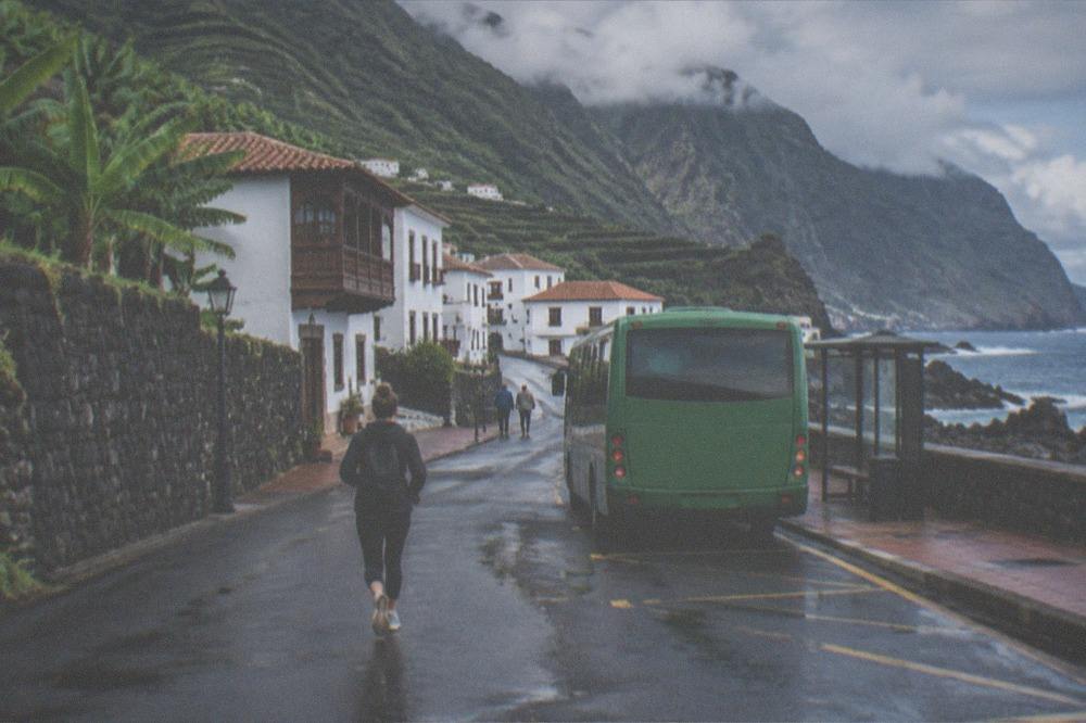
Garachico is reached by TITSA bus, with the practical visitor products being single tickets priced by route, the EUR 10 day travelcard or the EUR 50 seven-day travelcard, all sold at airport ticket machines. There is no tram link to this coast, public transport is not free for visitors, and the nearest airport with published bus connections on file is Tenerife North, served by TITSA lines 20, 30 and 343.
The visitor fare structure is worth knowing before the journey. TITSA's fares page lists single tickets priced by route with card or cash, a 10% discount on same-day returns for trips of 20 km or more, and the two travelcards in the table below. The 2026 100% subsidy the Canary government announced applies to resident passes only, so a visitor pays the published fares. Everything else covered here is indexed on Tenerife Travel Guide.
| Ticket | Price | Notes |
|---|---|---|
| Single ticket | Priced by route | Card or cash |
| Same-day return | 10% off | Trips of 20 km or more |
| Day Travelcard | EUR 10 | Visitor product |
| 7 Day Travelcard | EUR 50 | Visitor product |
| Ten+ card | EUR 2 | Top-ups EUR 2 to EUR 100 |
If the day starts from the north, the airport connections on file are these, per TITSA's own airport pages:
| Airport | TITSA lines | Destinations listed by TITSA |
|---|---|---|
| Tenerife North | 20 | Santa Cruz via La Laguna |
| Tenerife North | 30 | Puerto de la Cruz |
| Tenerife North | 343 | Express to the south |
From Puerto de la Cruz or Icod de los Vinos the town is a local bus ride; check TITSA's journey planner for the current line and timetable, because this site states only the lines the verified record holds. A car is another way in, and the driving in Tenerife guide covers the island's roads; the general legal drink-drive limit the DGT page refers to is 0.5 g/l in blood, worth knowing before a wine-lunch in La Orotava on the way.
For a day that ends in the capital, a guided bike or e-bike tour of Santa Cruz covers the highlights with a cruise-terminal start, and its listing carries the current options.
What Is the Weather Like on the North-West Coast?
AEMET's normals for its Tenerife North Airport station, the nearest with a published 1981 to 2010 series, show mean daily maxima from 16 Celsius in January to 25.7 in August and annual rainfall of 520 mm on 64 rain days of 1 mm or more. The north is wetter and milder than the south year-round, and the sea off the south coast runs 19.1 to 23.7 Celsius across the year in NOAA's 1991 to 2020 series.
The numbers matter for planning because this coast is a different climate regime from the resorts. Garachico sits on the green, Atlantic-facing north-west, and AEMET's station record for the north shows winter months carrying six to nine rain days, against under two a month at Tenerife South Airport in summer. A winter visit here should assume the possibility of a wet day, which the rainy day in Tenerife itinerary is built for.
| Month | Mean daily max C | Mean daily min C | Rain mm | Rain days of 1 mm or more |
|---|---|---|---|---|
| Jan | 16 | 10.2 | 80 | 7.7 |
| Feb | 16.7 | 10 | 70 | 7.4 |
| Mar | 18.2 | 10.7 | 61 | 6.8 |
| Apr | 18.5 | 10.9 | 39 | 6.2 |
| May | 20.1 | 12 | 19 | 3.8 |
| Jun | 22.2 | 14 | 11 | 2.4 |
| Jul | 24.7 | 15.7 | 6 | 1.7 |
| Aug | 25.7 | 16.6 | 5 | 1.1 |
| Sep | 24.9 | 16.5 | 16 | 2.8 |
| Oct | 22.5 | 15.2 | 47 | 6.5 |
| Nov | 19.6 | 13.3 | 81 | 8.3 |
| Dec | 17.1 | 11.5 | 82 | 8.8 |
Two readings of the same island are worth putting side by side, because they explain why the north-west looks the way it does. The south airport station records 132 mm of rain a year on 15.2 days; the north airport records 520 mm on 64 days. That fourfold gap in rainfall is why Garachico's hinterland is green farmland and forest while the resorts around El Médano sit in dry, sun-baked terrain. It is also why the pools here can be refreshingly cool even in August, and why the sea temperature series for the south coast, 19.1 Celsius in March to 23.7 in September and October, reads warmer than the Atlantic usually feels on this shore.
Can You Combine Garachico with Masca and the Cliffs?
Yes, and it is the standard combination. Garachico is the coastal stop on the Masca, Garachico and Icod route, the Los Gigantes cliffs that tower up to 600 m in Turismo de Tenerife's words sit south along the same coast inside Teno Rural Park, and the Masca gorge itself is open as a descent-only trail with a pre-booked boat exit under its pilot scheme.
The order of the loop matters. The Masca, Garachico and Icod route page covers the full day, but the facts that constrain it are these. Masca is not a free, drive-in walk: the operator's page states a general ticket of EUR 40.66 with the boat extra, a compulsory TITSA line 355 arrival from Santiago del Teide with private vehicles refused, closed mountain footwear as a condition of entry, and sudden pier closures from sea conditions that void the day's ticket. It is a booked, one-way descent, not a stroll.
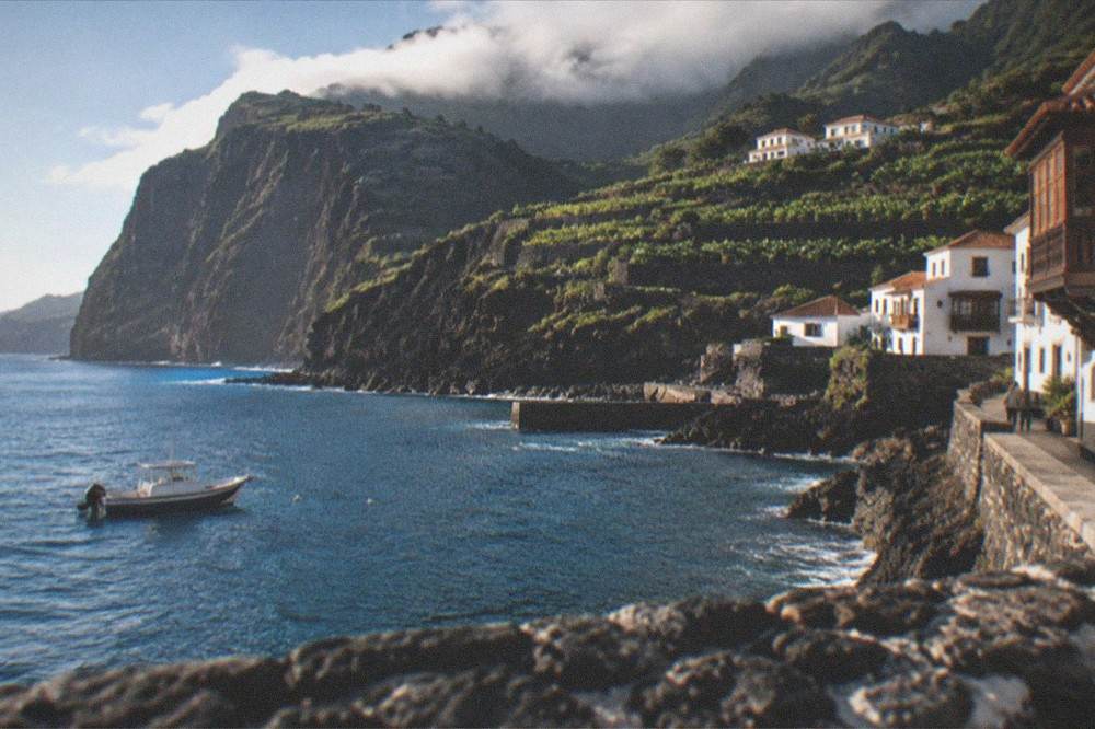
The cliffs need no booking at all. Turismo de Tenerife describes the Los Gigantes cliffs as towering up to 600 m, with the seabed about 30 m deep at their foot inside Teno Rural Park, and a boat trip out of the village shows them from below. Whale watching on this coast is regulated by Decreto 178/2000: no approach within 60 m, at most three boats within 500 m, 4 knots within 500 m, no swimming within 500 m, and authorised boats fly the Barco Azul flag.
The charges that exist on this route are per-booking fees on specific sites, and they are the only ones a visitor to the north-west will meet:
| Site | Charge | Who pays it |
|---|---|---|
| Masca gorge trail | EUR 40.66 general ticket, boat extra | Tenerife residents and federation members enter free |
| Barranco del Infierno | EUR 15 non-resident adult | EUR 5 for Canary residents, advance booking compulsory |
| Teide summit trail PNT 10, 09:00 to 17:00 slots | EUR 15 for visitors | EUR 6 for other Canary residents, free for Tenerife residents and children |
| Garachico town and pools | No entry charge listed | Everyone |
For walkers who want the landscape without the Masca booking discipline, a guided day hike with south-coast pickup covers Tenerife's great outdoors on routes the guide chooses for the conditions.
And for a fuller sweep of the north-west in one booked day, these are the tours this site rates for the area:
Where to Stay in and Around Garachico?
Garachico itself is a small town of quiet nights rather than resort infrastructure, and most visitors either day-trip in or base in nearby Icod de los Vinos, Puerto de la Cruz or the villages of the north-west. No nightly rate can be quoted, because rates move daily, but the cost drivers are the same as the rest of the island: season, exact location and how far ahead you book.
Staying in the town puts the pools and the old quarter on the doorstep and trades that for a limited restaurant and nightlife scene, a fair swap for many travellers and a poor one for anyone who wants evening entertainment. The where to stay in Tenerife guide compares the bases properly. For a shortlist of places to stay around Garachico and the north coast, the season matters more than the postcode: AEMET's normals show the north at its driest and warmest from June to August.
One legal point worth knowing, because the internet is loud about it: no official page read shows a per-night tourist tax in force or approved on Tenerife. The charges that do exist are per-booking fees on specific trails and sites, and the tourist tax and local rules page lists them all. The other rule worth carrying on this coast is the wildfire measure in force across Teide National Park: the Cabildo bans smoking in all open-air spaces of the park, car parks included, and bookings there can be suspended for fire risk or weather alerts.
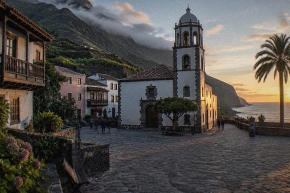

Common Questions About Garachico
Was Garachico destroyed by a volcano?
Yes. Turismo de Tenerife's page for the municipality records that the Trevejo volcano erupted in 1706, destroyed almost the entire town and buried the old port, and that Garachico had been the island's trade hub in the 16th and 17th centuries before the eruption.
Can you swim in the Garachico natural pools?
Swimming depends on Atlantic sea conditions, because the pools are sea-fed basins in the lava seafront. No opening hours or season dates for the pools are on file, so check sea state on the day and treat the pools as weather-dependent rather than guaranteed.
Is there a beach in Garachico?
The town's coast is the dark lava flow the 1706 eruption left, with sea swimming in the natural pools rather than on a sandy beach. Visitors who want golden sand should look at the island's golden sand beaches, such as Las Teresitas and Las Vistas, which the tourist board describes in those words.
Do you need a car to visit Garachico?
No. TITSA buses reach the town, and visitors pay for public transport: single tickets priced by route, the EUR 10 day travelcard or the EUR 50 seven-day travelcard. The free public transport subsidy announced for 2026 applies to resident passes only. Guided tours of the Masca, Garachico and Icod route also run without a car.
Is Garachico close to the Los Gigantes cliffs?
Yes, they are on the same north-west coast. Turismo de Tenerife describes the Los Gigantes cliffs as towering up to 600 m high, with the seabed about 30 m deep at their foot, inside Teno Rural Park, south of Garachico along the Teno coast.
How far is Garachico from Icod de los Vinos?
The two towns sit next to each other on the north-west route and are normally visited on the same loop, but no driving time or distance between them is on file, so check the route planner or the bus timetable for the current figure rather than a guide's estimate.