The Best Photography Spots in Tenerife
Tenerife packs a UNESCO-listed volcano, a laurel forest, cliffs that the tourist board measures at up to 600 m and beaches of three different sand colours into one island. This guide sets out where the strongest photographs come from, and what the official rules, hours and fees mean for a shooting day.
Short answer
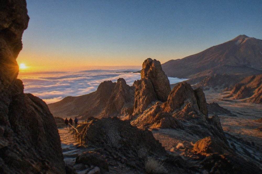
The strongest photography in Tenerife comes from four settings: the volcanic high ground of Teide National Park, the laurel forest of the Anaga massif, the cliffs and sea around Los Gigantes, and the island's varied beaches. Each has its own light, its own access rules and its own official fees, and this guide lists them all.
Tenerife is a small island with an unusually wide range of subjects for a camera. The national park at its centre holds a stratovolcano that Spain's own environment ministry measures at 3,715 m, and UNESCO records as "the highest peak on Spanish soil". An hour's drive north, the Anaga massif keeps a laurel forest whose trails the Cabildo protects with a reservation system. On the west coast the Los Gigantes cliffs, in the tourist board's words, "tower up to 600 m" above water about 30 m deep. The beaches alone come in three colours, grey, golden and black, each documented on the tourist board's own pages.
This guide walks through those settings in the order a photographer would plan them: the volcano first, because its light and its permits set the tightest schedule, then the forest, the cliffs and the coast, then the practical questions of light, season and transport. Every hour, fee and rule below comes from an official page, and where two official sources disagree, both readings are shown. For a broader plan around the camera stops, the things to do in Tenerife page covers everything else on the island.
Where Are the Best Photography Spots in Teide National Park?
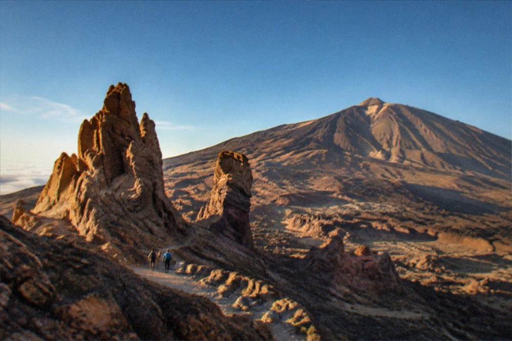
The best photography in Teide National Park centres on Roques de Garcia, the cable car's upper station at La Rambleta and the viewpoints along the road through the park, all reachable without any booking, while the crater trail PNT 10 needs a personal reservation on Tenerife ON and the cable car needs an operator ticket. No official page lists an entry fee for the park itself, so driving the road and stopping at the viewpoints costs nothing. The charges that exist are per-booking public fees on two trails only, PNT 10 and PNT 07, in force since Monday 19 January 2026.
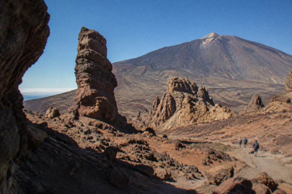
The park is not a quiet corner. It recorded 5,242,653 visitors in 2024, the most visited park in Spain's national park network, out of a network total of 16,006,242. That number shapes a photography day more than any lens choice: the viewpoints are busiest in the middle of the day, and the cable car's own timetable, 09:00 to 17:00 in its standard season, funnels almost everyone into the same hours. The operator's rules also matter for gear. The Cabildo bans smoking in all open-air spaces of the park, car parks included, a wildfire measure, and in winter ice and snow add crampons and an ice axe to the mandatory equipment list on the stratovolcano trails.
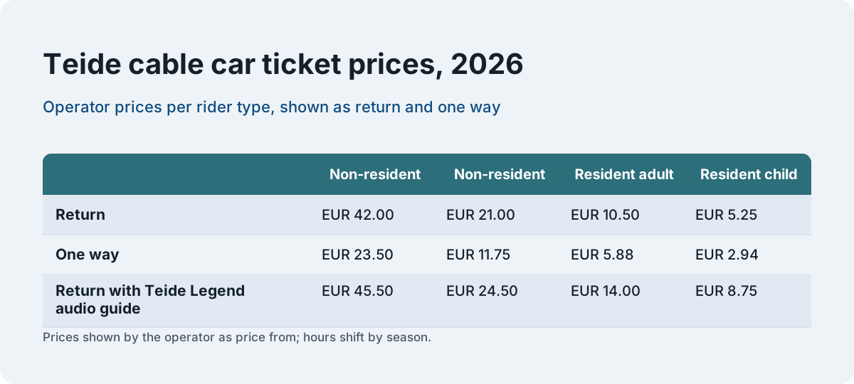
The cable car is the fastest way to high ground for a landscape frame. It runs from a base station at 2,356 m to La Rambleta at 3,555 m, and it does not reach the summit: the crater is a separate, permit-only trail. The operator refuses the ride to people with cardiovascular conditions, pregnant women and children under 3, and the last ascent is one hour before closing, the last descent ten minutes before.
| Cable car ticket, 2026 | Non-resident adult | Non-resident child (3 to 13) | Resident adult | Resident child |
|---|---|---|---|---|
| Return | EUR 42.00 | EUR 21.00 | EUR 10.50 | EUR 5.25 |
| One way | EUR 23.50 | EUR 11.75 | EUR 5.88 | EUR 2.94 |
| Return with Teide Legend audio guide | EUR 45.50 | EUR 24.50 | EUR 14.00 | EUR 8.75 |
The operator shows the return ticket as "price from", and the hours shift by season: 09:00 to 17:00 in the standard periods, extended to 18:40 in the summer weeks and the Easter window. Anyone planning a sunset frame from La Rambleta should read the current timetable on the operator's page rather than any fixed rule, because the closing time is what decides whether the light is still there when the last cabin descends.
For the crater itself, the trail PNT 10 Telesforo Bravo needs a personal reservation booked on Tenerife ON, and the full permit story, including the weekly Monday 07:00 release rule that keeps 56 days bookable, is on the Teide summit permit page. The fee table below is the one the booking site itself publishes.
| Trail, 09:00 to 17:00 slots | Tenerife residents | Other Canary residents | All other users |
|---|---|---|---|
| PNT 10 Telesforo Bravo (summit) | EUR 0 | EUR 6 | EUR 15 |
| PNT 07 Montana Blanca, working days | EUR 0 | EUR 3 | EUR 6 |
| PNT 07 Montana Blanca, weekends and public holidays | EUR 0 | EUR 5 | EUR 10 |
Children are exempt from the PNT 10 fee, though the official page gives two different age cut-offs, so the booking page is the place to check which band applies. Bookings are non-refundable, with no changes of date, slot or names, and a no-show can bar a user from new applications for three months. The 06:00 to 09:00 and 18:00 to 22:00 slots, the sunrise and sunset windows a photographer actually wants, are listed as bookable reservations too, and walking without one can be penalised.
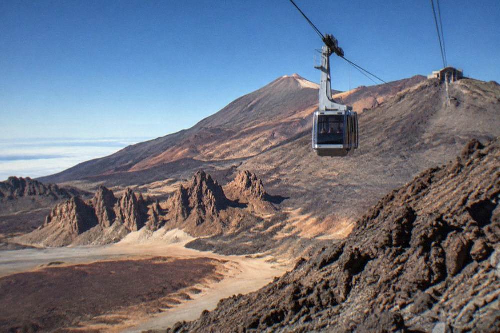
One more official note belongs here, because it is the kind of thing a first page of search results gets wrong: UNESCO describes Teide as rising 7,500 m above the ocean floor and "regarded as the world's third-tallest volcanic structure", and that exact wording, "volcanic structure", not "volcano", is the only supportable form.
What Is the Most Beautiful Part of Tenerife?
The Anaga massif, in the island's north-east, is the part most official descriptions single out for beauty: a laurel forest inside a rural park, with reservation-only trails, coastal rock formations at Benijo and Roque de las Bodegas, and a light that AEMET's own station data shows is softer and cloudier than the south. It is also the part of Tenerife that behaves least like a holiday island, which is exactly why it photographs so well.
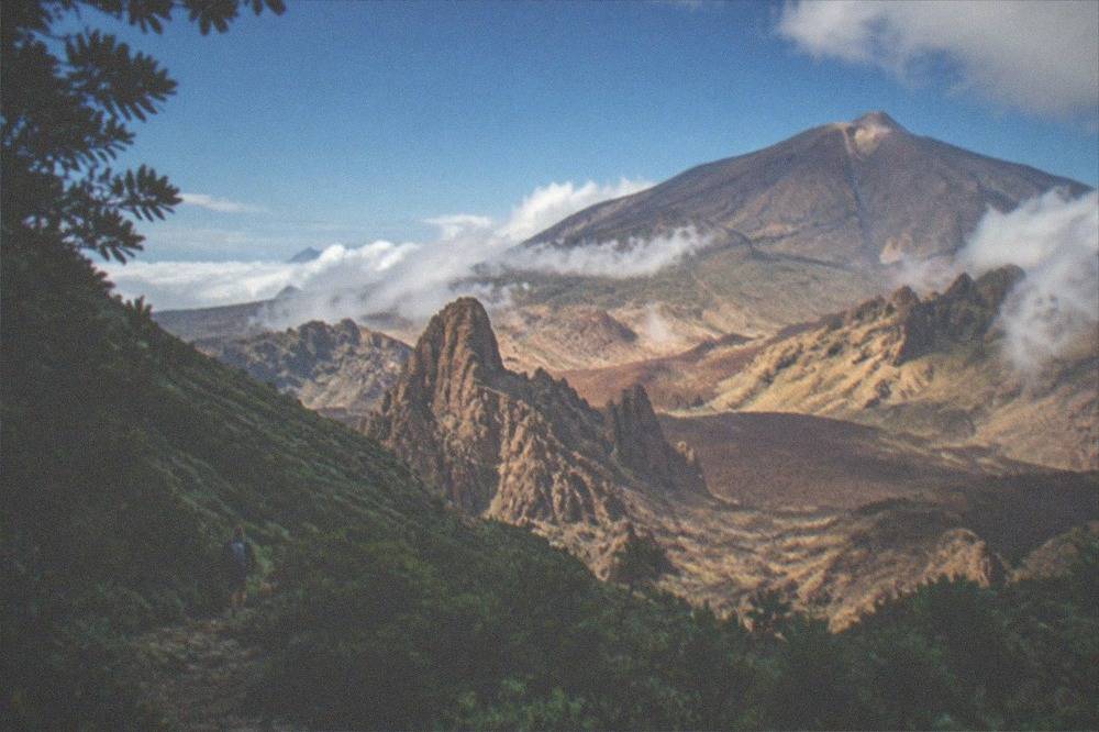
The Cabildo protects the best-known stretch of it. El Pijaral, the trail the brochures call the Enchanted Forest, is a loop from La Ensillada through an integral nature reserve, and it needs a prior reservation on Tenerife ON, released Mondays at 07:00 Canary time and bookable at most 14 days ahead. Organised tours by companies are not permitted there, so no operator can walk a group through it, which keeps the reserve quiet in a way few places on the island still are. The Cabildo names two permit-free alternatives in the same massif, the Bosque de los Enigmas trail and the Pista de Las Hiedras.
The forest is only half the subject. Anaga's northern coast puts black sand and jagged rock against open Atlantic, and the tourist board's pages for those beaches describe exactly that. A guided walk is the practical way to reach the quieter trails, and the full-day Anaga hike below covers the laurel forest with hotel pickup from the south.
The hike runs about seven hours and is rated 5.0 from 155 reviews on its listing. For photographers the value is simple: the trails that need no reservation are still easy to miss without local knowledge, and the light inside the laurel forest changes ridge by ridge.
For anyone weighing the north against the south more generally, the Tenerife north vs south comparison sets out the two halves of the island in detail.
Which Cliffs and Coastline Give the Best Seascapes in Tenerife?
The Los Gigantes cliffs, which the tourist board says tower up to 600 m above a seabed about 30 m deep, are the island's defining seascape, best photographed from the water, and the whale-watching boats that work that coast operate under a decree that sets exact approach distances, 60 m minimum, at most three boats within 500 m. The cliffs sit inside Teno Rural Park on the west coast, and the tourist board's own figures are the ones to trust here: older guides print larger numbers, but "up to 600 m" is the official wording.
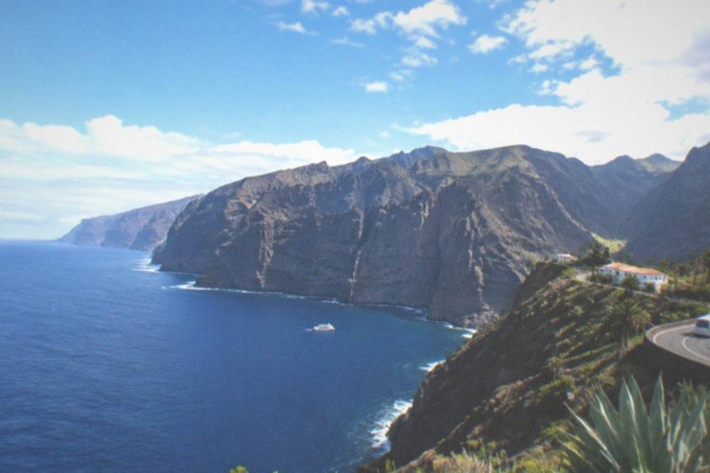
From the water the scale of the cliffs reads properly, and the same trip usually carries the island's other signature subject: the resident pilot whales and bottlenose dolphins of the south-west coast. The World Cetacean Alliance describes a "unique resident population of pilot whales" and a migration stop for 21 other cetacean species inside a Special Area of Conservation, and it designated the Tenerife-La Gomera Marine Area a Whale Heritage Area in January 2021. That designation is the WCA's, not UNESCO's, a distinction worth getting right in any caption.
The rules that shape how close a boat, and therefore a camera, gets are in Decreto 178/2000 of the Canary government.
| Rule under Decreto 178/2000 | Figure |
|---|---|
| Minimum approach distance to any cetacean | 60 m |
| Maximum boats within 500 m of an animal | 3 |
| Maximum speed within 500 m | 4 knots |
| Swimming or diving within 500 m | Prohibited |
| Feeding, chasing or circling | Prohibited |
Authorised boats must fly the Barco Azul flag, issued with the permit and renewed each year, so a flag on the mast is the visible proof a trip operates inside the rules. A no-chase trip is also the better photography trip: a boat that holds its distance gives the animals a steady background and the photographer time to work.
The eco-cruise below runs from Costa Adeje with food and drinks included, three hours on the water, rated 4.6 from 5,782 reviews.
Further north along the same coast, Garachico adds a different frame: the tourist board records that the Trevejo volcano erupted in 1706, destroyed almost the entire town and buried the old port, and the natural pools that visitors photograph today sit in that history. The pools are free to look at and cost nothing to walk around, one more reminder that much of the island's best material is not a booking at all.
Which Beaches in Tenerife Photograph Best?
Tenerife's beaches split cleanly by colour on the tourist board's own pages: golden sand at Las Teresitas and Las Vistas, grey sand at El Duque and El Medano, pale sand at Fanabe and black sand at El Bollullo, so a photographer can plan a three-colour set in a single day. The board's descriptions are specific, and they correct a lot of lazy copy: El Duque is a grey sandy beach, not the golden strip some pages claim.
| Beach | Municipality | Sand, per the tourist board |
|---|---|---|
| Las Teresitas | Santa Cruz (San Andres) | Golden, palms, breakwaters |
| Las Vistas | Arona | Golden, calm behind breakwaters |
| Playa del Duque | Adeje | Grey |
| Fanabe | Adeje | Pale |
| El Medano | Granadilla de Abona | Fine grey, under Montana Roja |
| El Bollullo | La Orotava | Black, at the foot of a cliff |
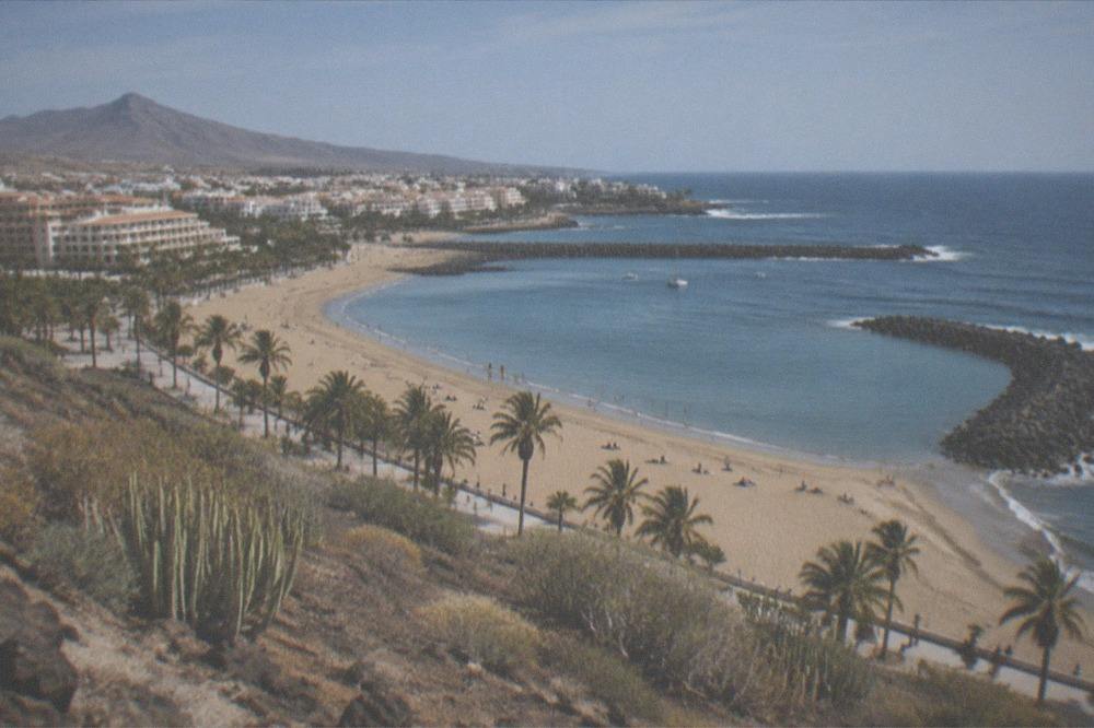
Las Teresitas is the postcard of the east coast: golden sand, palm trees and breakwaters that calm the water, in the fishing village of San Andres just north of Santa Cruz. Las Vistas, between Los Cristianos and Playa de las Americas, does the same job in the south. El Medano is the wind-sports beach, fine grey sand under Montana Roja, and El Bollullo is the wildest of them, black sand at the foot of a cliff in La Orotava.
None of these beaches charges for access, and none needs a booking. The only coastal walks on the island that do are the reservation trails, among them Masca and Barranco del Infierno, and both are covered below.
What Is the Best Light for Photography in Tenerife?
AEMET's climate normals show the sharpest seasonal contrast in the island's light: the south coast station records 337 sunshine hours in July against 168 in December, while the Izana station on the Teide ridge at 2,369 m records 382 hours in June and July and just 218 in December, so summer delivers more than twice the shooting light of winter. The sea adds its own pattern: NOAA's 1991-2020 surface data puts the water at 23.7 Celsius in September and October and 19.1 in March, its low point.
| Month | Izana sunshine hours | Santa Cruz sunshine hours | Sea surface C |
|---|---|---|---|
| Jan | 226 | 178 | 19.9 |
| Mar | 260 | 221 | 19.1 |
| Jun | 382 | 306 | 21.4 |
| Sep | 295 | 253 | 23.7 |
| Dec | 218 | 168 | 21.1 |
The two air columns are AEMET's 1981-2010 normals and the sea figures are NOAA's 1991-2020 series, two datasets and two periods, and no page should print one period for both. What the numbers mean in practice is a planning fact: the south is the reliable base, the Teide ridge carries its own weather, and the north coast around Tenerife North Airport is the wettest corner of the island, with 520 mm of rain across the year on AEMET's published annual figure against 132 mm at the south airport. Other pages covering the same trip are gathered on Tenerife Travel Guide.
The month-by-month detail, including rainfall and temperatures at all four stations, is on the Tenerife weather by month page. For the volcano specifically, the Izana numbers matter most: rain days of 1 mm or more run at 4.5 in January and zero from June to August, and the station's mean daily maximum is 7.5 Celsius in January against 23 in July. A winter sunrise shoot on the ridge is a cold-weather job.
Which Gorges and Waterfalls Need a Reservation in Tenerife?
Two of the island's most photogenic walks are reservation-only: the Masca gorge, a descent with a compulsory boat exit that costs EUR 40.66 general admission plus the boat, and Barranco del Infierno in Adeje, EUR 15 for a non-resident adult, with advance online booking compulsory and a quota of 20 people every 30 minutes. Neither is a free stroll, and both have entry rules that a photographer ignores at the cost of the whole day.
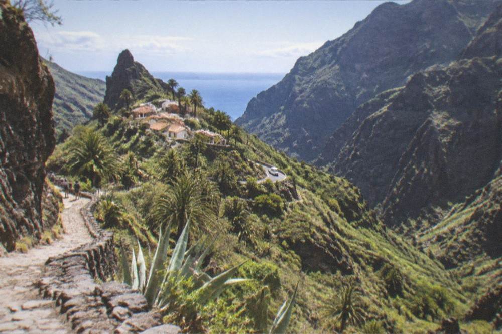
Masca runs under a continuing pilot scheme: descent only, leaving by boat from Masca bay, with the boat ticket booked separately and for no later than four hours after the descent slot. Hikers must arrive on TITSA line 355 from Santiago del Teide and show the bus ticket; arriving by private vehicle means refusal. Closed mountain footwear is a condition of entry, the pier can close suddenly when the sea turns, and the operator itself calls the gorge the place with the most rescues in the Canaries in recent years. Tenerife residents and Canarian federation members enter free, paid up front and refunded after the control point.
Barranco del Infierno is the gentler of the two and ends at a waterfall, the only one of its kind on the walkable island trails. Children under 5 are not allowed, the child ticket runs from 5 to 12, and Canary residents pay EUR 5.
How Do You Reach Tenerife's Photography Spots Without a Car?
Tenerife's buses reach both airports and most of the photography stops, and visitors pay for them: single tickets priced by route, a EUR 10 day travelcard or a EUR 50 seven-day travelcard, because the 100% fare subsidy the Canary government announced for 2026 applies to resident passes only. A personalised Ten+ card and Canary residency are what the free travel requires, so no visitor qualifies.
| TITSA product | Price | Notes |
|---|---|---|
| Single ticket | Priced by route | Card or cash on board |
| Same-day return | 10% off | On trips of 20 km or more |
| Day Travelcard | EUR 10 | Visitor product |
| 7 Day Travelcard | EUR 50 | Visitor product |
| Ten+ card | EUR 2 | Wallet top-ups EUR 2 to EUR 100 |
The airport lines are on TITSA's own airport pages: lines 10, 40, 711, 343 and 415 serve Tenerife South, and lines 20, 30 and 343 serve Tenerife North. There is no tram to either airport, and the resident-subsidised passes exclude the Teide and Teno lines, the two that matter most for exactly the landscape work this page describes. The full network detail is on the Tenerife buses and TITSA page, and anyone weighing a hire car against the buses can read the car hire in Tenerife comparison before deciding.
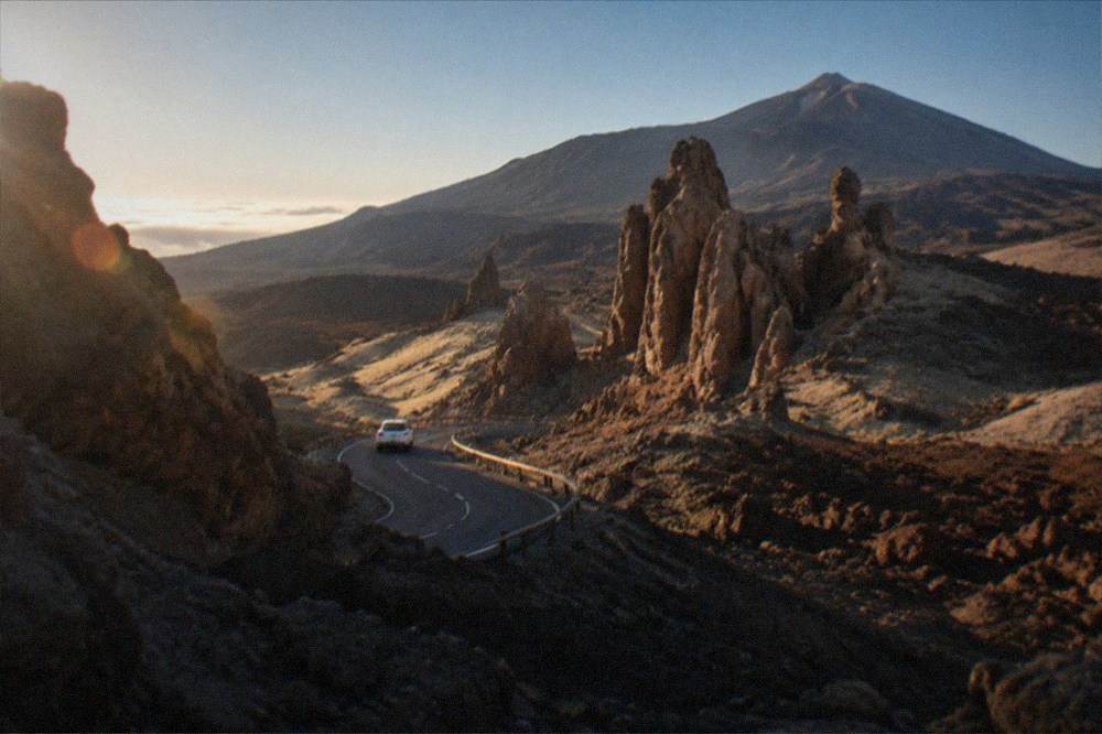
For a day that strings several stops together without driving, a full-day guided island tour covers the loop, and the one below is rated 4.5 from 374 reviews over eight hours with a northern focus.
Anyone who would rather base themselves near the subjects than commute to them should read the where to stay in Tenerife guide, which sets out each area against exactly this kind of day plan.
What Should a One-Day Photography Plan for Tenerife Look Like?
A realistic one-day plan puts the volcano first in the morning light, the Anaga forest or the north coast in the middle of the day, and the Los Gigantes cliffs or a south-west boat trip into the late afternoon, because the cable car's last ascent is one hour before closing and the best boat light is after 16:00. The island is small enough on the map for a longer list, but the roads through the national park and the Anaga ridges are slow, and a plan that ignores that ends up shooting from a moving window.
Three practical notes finish the plan. First, the smoking ban covers every open-air space in the national park, so a break for a cigarette anywhere in the frame is a fine, not a footnote. Second, the summit trail's sunrise and sunset slots, 06:00 to 09:00 and 18:00 to 22:00, are the ones a photographer wants, and they are bookable reservations, not free hours. Third, the Altavista refuge has reopened after refurbishment with 49 beds and takes prior reservations, which makes a sunset-and-sunrise shoot on the high ground possible without a night descent, though the official pages conflict on its exact altitude, 3,260 m in one notice and 3,200 m in another, and a night there does not replace the summit permit.
Common Questions About Photography Spots in Tenerife
What Is the Most Beautiful Part of Tenerife to Stay In?
The official descriptions point north and east for beauty: the Anaga massif's laurel forest and the north coast around Puerto de la Cruz and La Orotava, with the volcanic high ground in the middle of the island. The south is where the golden-sand beaches and the boat trips are, and the where to stay in Tenerife page compares the areas for access, atmosphere and cost.
Do You Need a Permit to Photograph on Mount Teide?
No permit is needed to photograph from the road, the viewpoints or the cable car, only an operator ticket for the cable car itself. The crater trail PNT 10 needs a personal reservation on Tenerife ON, and its 09:00 to 17:00 slots cost EUR 15 for visitors since 19 January 2026. The sunrise and sunset slots, 06:00 to 09:00 and 18:00 to 22:00, are also bookable reservations.
Is There an Entry Fee for Teide National Park?
No official page lists an entry fee for the park. The charges that exist are per-booking public fees on two trails, PNT 10 and PNT 07, and the cable car is a separate operator ticket. Driving through and stopping at the viewpoints carries no charge on any page read.
When Is the Sea Warmest for Coastal Photography in Tenerife?
NOAA's 1991-2020 surface data puts the sea at 23.7 Celsius in both September and October, the annual peak, falling to 19.1 Celsius in March. The same months carry some of the year's best sunshine hours on the south coast, 253 hours in September on AEMET's Santa Cruz normals.
Can You Photograph the Pilot Whales Close Up?
No. Decreto 178/2000 prohibits any approach within 60 m of a cetacean, allows at most three boats within 500 m, caps speed at 4 knots inside that zone and bans swimming within 500 m. Authorised boats fly the Barco Azul flag, which is the visible proof a trip operates inside the rules.
Is the Masca Gorge Open for Photography Walks?
Yes, under a continuing pilot scheme: descent only, with a pre-booked boat exit, a EUR 40.66 general ticket plus the boat, arrival on TITSA line 355 from Santiago del Teide and closed mountain footwear. The pier can close suddenly when sea conditions turn, which voids that day's ticket.